

- Multiple global and regional online maps Including Bing, Yandex, Open Street Maps, OSM Cycle, OSM Public Transport, Multimap (UK), OutdoorActive (Germany, Austria, South Tyrol), Cykloatlas, HikeBikeMap (Germany), Open Piste Map, NearMap (Australia), and many others.
- All maps are automatically cached for offline use You can use Mobile Atlas Creator to create or download map tiles and MAPC2MAPC to manipulate maps and convert them between different platforms and software.
- Go caching! Create custom geocache queries on geocaching.com. Queries that contain 500 geocaches or fewer can be delivered as an email attachment.
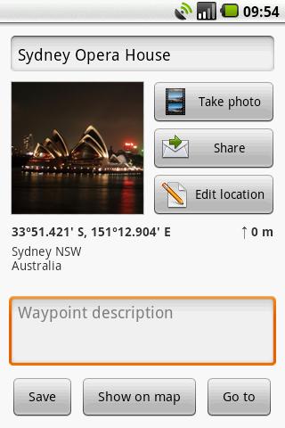
- Share your current or planned location Send your address, GPS coordinates, and a link to Google Maps or even a map image.
- Save places you visit Waypoints are stored in a KML file that can be viewed and edited in Google Earth.
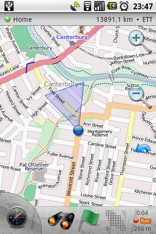
- Navigate easily A built-in radar shows the direction, distance, and estimated time to a point of interest.
- Record your tracks with a single tap Export tracks as GPX files that can be viewed in Google Earth and other programs.
- Upload tracks to GPSies.com You can use GPSies.com to view and download tracks that have been recorded by a GPS device. Please note that a free account is required for uploading.
- Trip computer See your speed, altitude, pitch, etc.
 |
| Link for Android Market |
Important GPS tips:
It can take about 45 seconds to acquire satellite signals when you
first start the application, or roughly 15 seconds if it has been used
recently. Because the signal cannot pass through solid non-transparent
objects, GPS requires an unobstructed view of the sky to work correctly.
Thus, signal reception can be degraded by tall buildings, bridges,
tunnels, mountains, etc. Also, moving around while locking onto several
satellites makes it harder for those separate signals to triangulate
your exact location. Please try to stand still when receiving a GPS fix,
unless there is absolutely no alternative.
0 comments:
Post a Comment